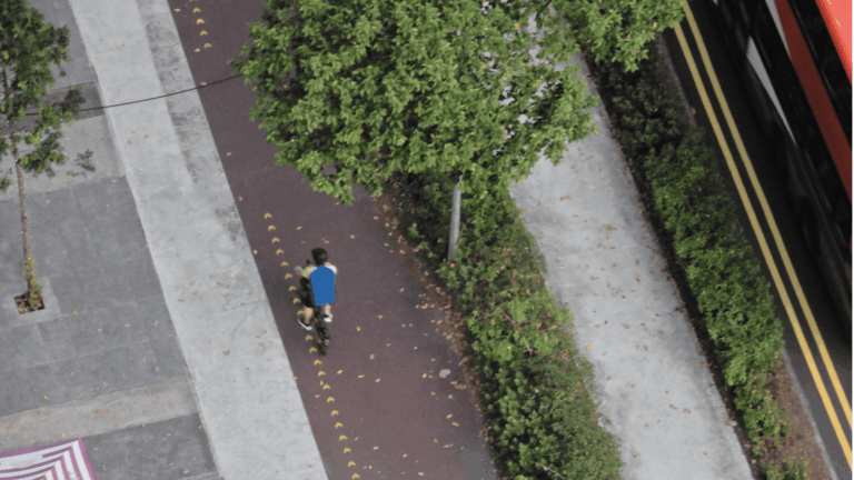

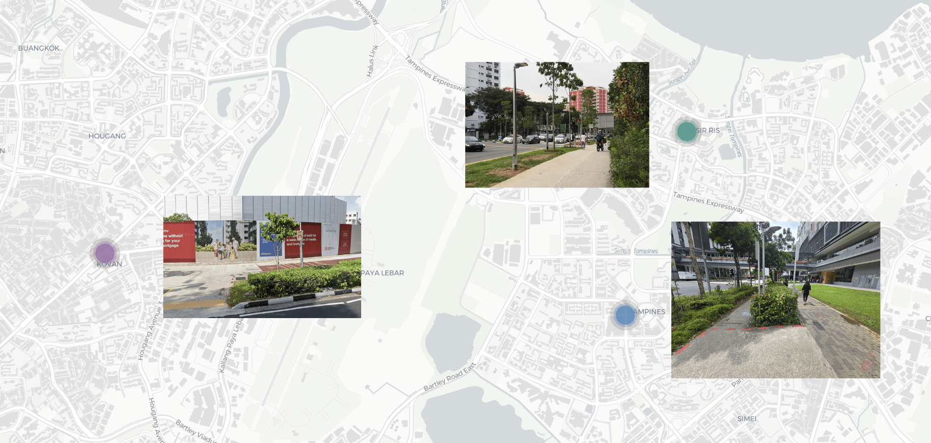
We conducted field observations across three locations — Pasir Ris, Tampines, and Kovan — during peak hours to study real behaviours of both pedestrians and AMD users. Sites were selected based on a 4:1 pedestrian-to-AMD ratio criterion.
Our observations revealed that 21% of AMD users at Pasir Ris did not ring their bell, 19% rode at excessive speeds, and up to 70% of pedestrians at Tampines did not react to a bell. We also ran an online survey and a statistical analysis, which showed that pedestrians feel just as safe as AMD users — confirming that complacency, not fear, is the root issue.
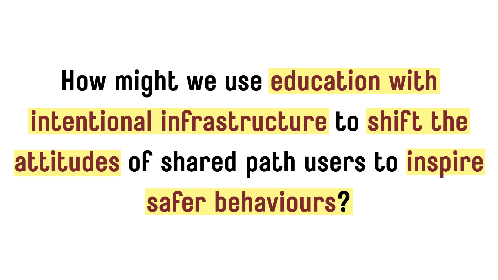
From our research, we identified four key issues: lack of knowledge of the rules, lack of application in practice, lack of an avenue to report issues, and confusion over the definition of a “shared path.”
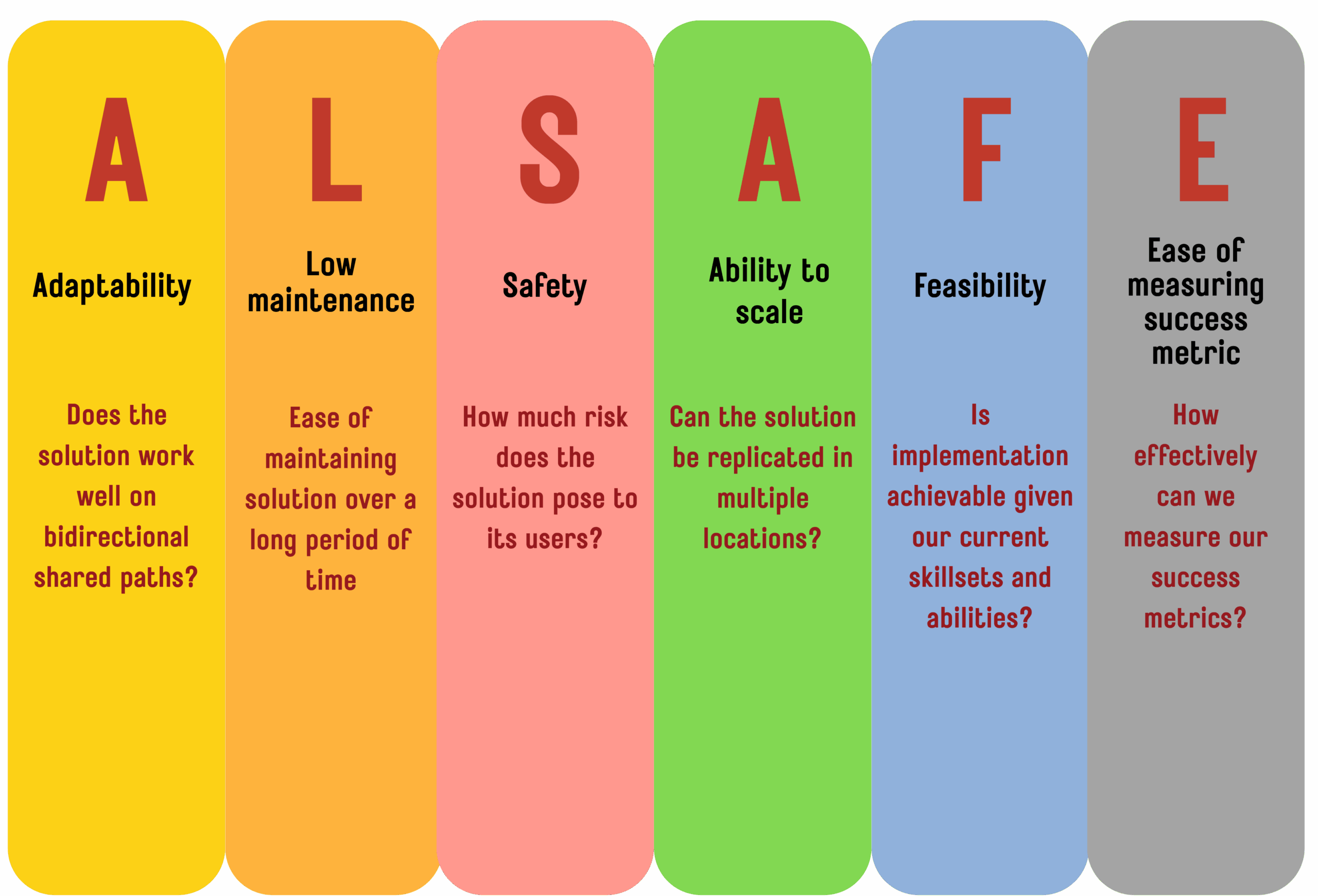
To evaluate our ideas, we developed the ALSAFE framework — scoring solutions across Adaptability, Low Maintenance, Safety, Ability to Scale, Feasibility, and Ease of Measuring Success. After scoring over 15 brainstormed concepts, we narrowed down to a two-pronged approach: outdoor physical interventions to subconsciously guide behaviour on-site, and an indoor educational experience to build lasting knowledge and measure impact.
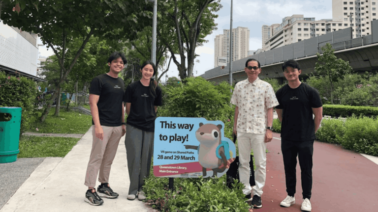
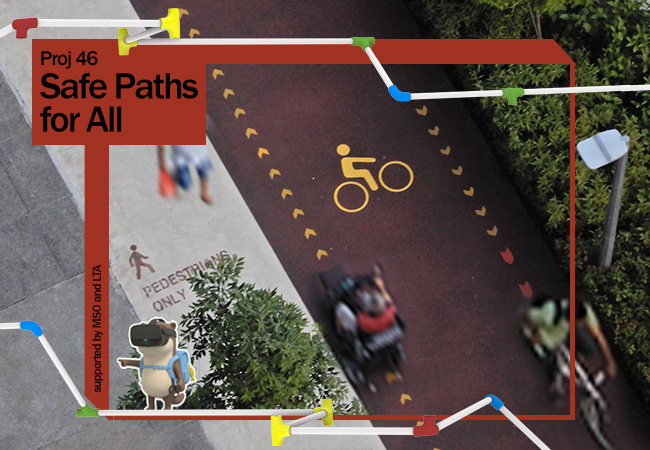
Our two-pronged solution was deployed at 38 Commonwealth Ave and Queenstown Library.
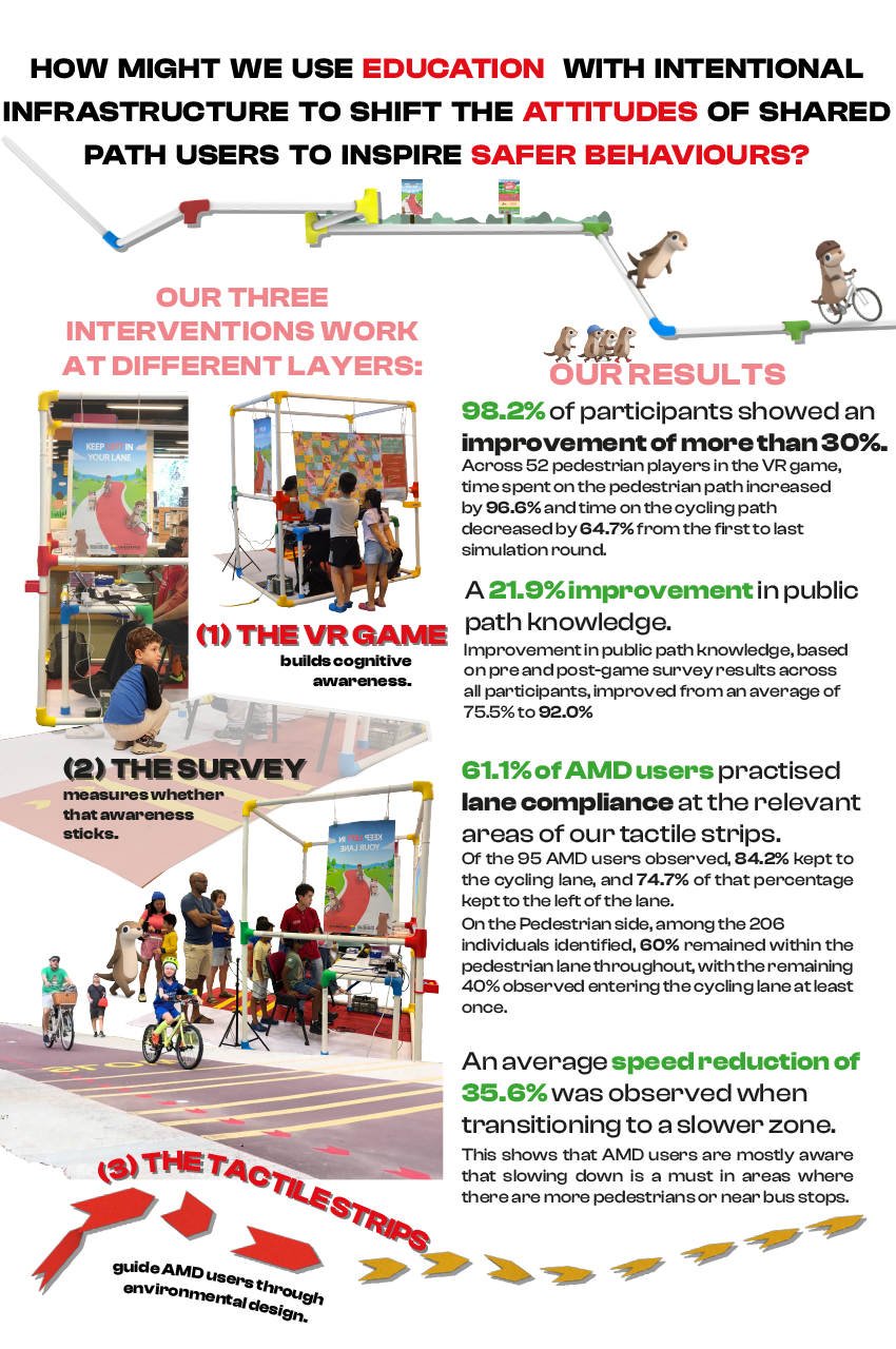
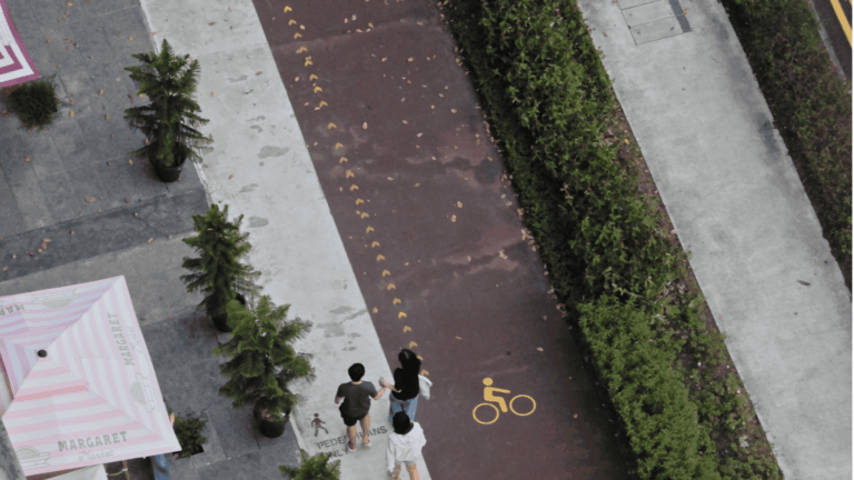
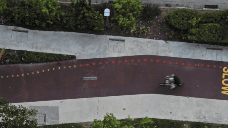
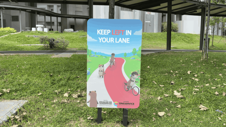
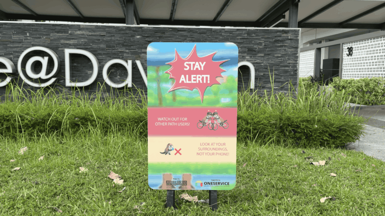
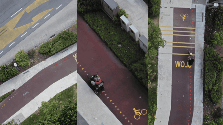
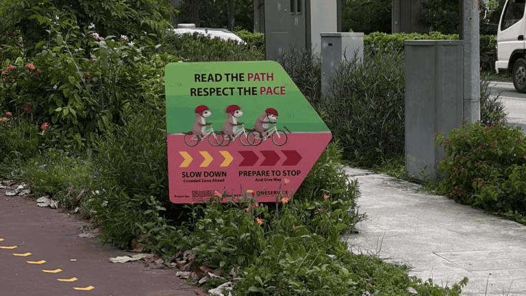
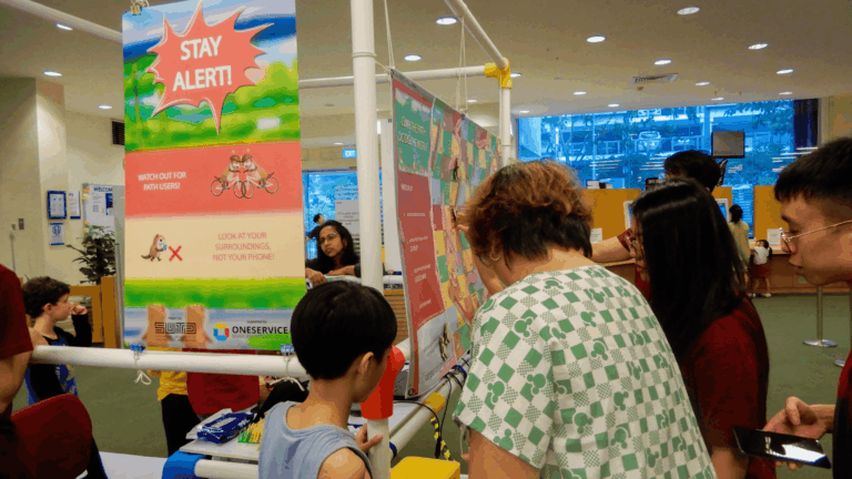
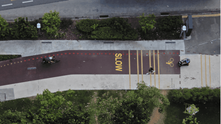
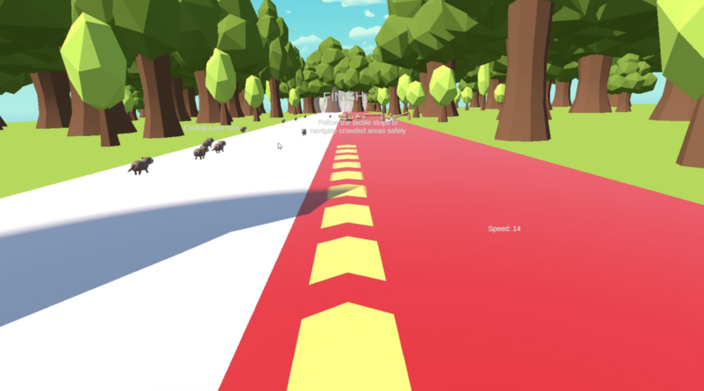
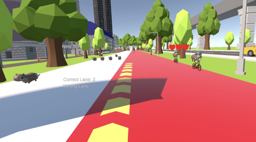
Outdoors, research-backed tactile strips use Edge Rate theory and colour psychology to subconsciously slow AMD users, transitioning from yellow (slow down) to red (stop/dismount). Standees at key points along the path communicate three safety messages and direct users to the booth.
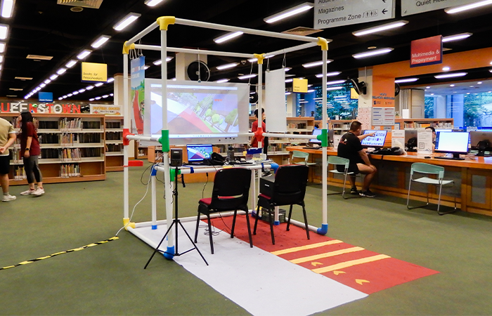
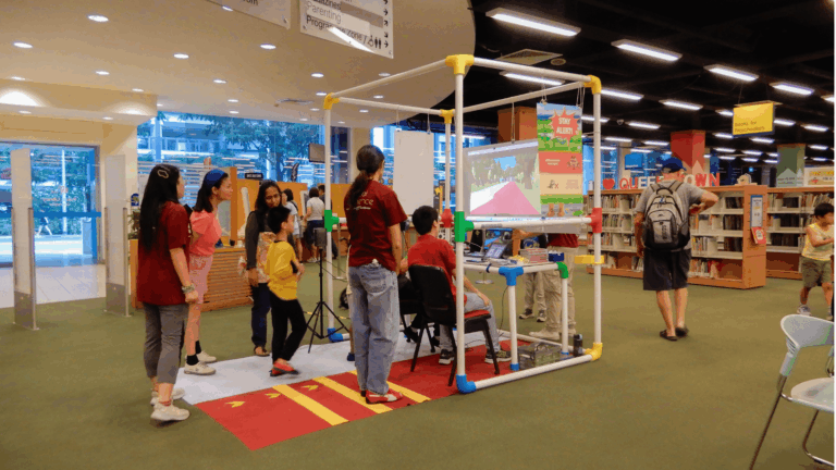
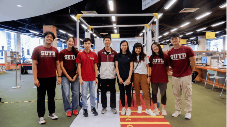
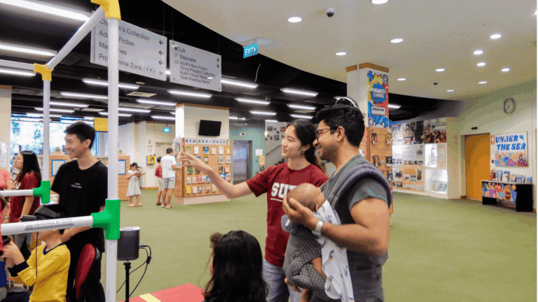
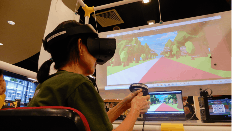
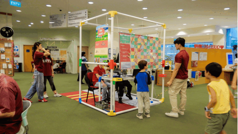
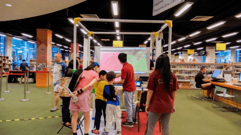
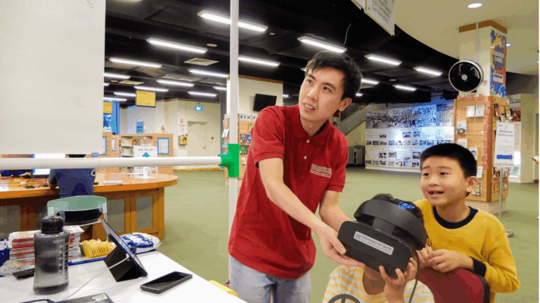
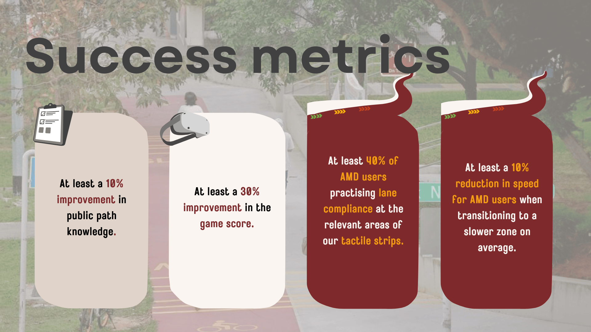
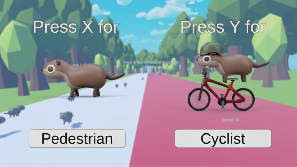
Indoors, a modular VR booth hosts a role-based game where players experience the shared path as either a pedestrian or cyclist, completing lesson rounds built around six key messages. A pre- and post-game survey with 17 scored questions measures knowledge transfer, targeting a 30% improvement in survey scores and a minimum score lift of 5 points per player.
Our field observations across Pasir Ris, Tampines, and Kovan during peak hours uncovered behaviours that shaped every design decision. 21% of AMD users at Pasir Ris did not ring their bell, 19% rode at excessive speeds above 25 km/h, and up to 70% of pedestrians at Tampines did not react to a bell at all. At 38 Commonwealth Ave, 47% of pedestrians walked on the wrong path, rising to 61% among those using their phones.
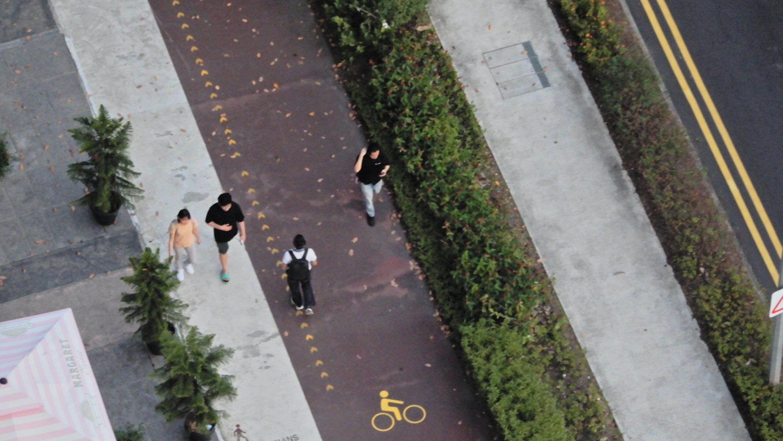
Most strikingly, our statistical analysis showed no significant difference in how safe pedestrians and AMD users feel on shared paths (p = 0.34). Pedestrians feel just as safe as the riders zooming past them. Complacency, not fear, is the root issue, and that fundamentally shaped our approach towards education over enforcement.
From this, we identified four root causes: lack of knowledge of the rules, lack of application in practice, lack of an avenue to report issues, and confusion over what a “shared path” actually means.
To move from research to solution, we developed the ALSAFE framework, a weighted scoring system used to evaluate over 15 brainstormed concepts across six criteria: Adaptability, Low Maintenance, Safety, Ability to Scale, Feasibility, and Ease of Measuring Success Metrics.
Safety was weighted highest (1.0), followed by Adaptability and Ability to Scale (0.8 each). This ensured our final solution could work across different path types, be replicated at other sites, and most importantly, not introduce new risks to path users.
We studied four local initiatives and international examples from Seville, Oregon, and Vancouver. A consistent finding across all cases: infrastructure alone is insufficient. Lasting behavioural change requires education, repetition, and habit formation.
Our two-pronged solution targets both the on-site experience and off-site education of shared path users. The three tabs below break down the key components: the science behind our tactile strip design, how our VR game works, and how we measure success.

Our tactile strips use Edge Rate theory, where thick chevron shapes placed in the rider’s peripheral vision trick the brain into perceiving higher speed, prompting instinctual deceleration. The colour system transitions from yellow (slow down) to red (stop/dismount).
The design is also inclusive. Progressive increases in arrow size across the three zones mean users can distinguish between Maintain, Slow Down, and Stop/Dismount by shape alone, without relying on colour. This ensures accessibility for the roughly 8% of male users with colour vision deficiency.
Green strips were removed from the final design as green is commonly associated with “go” and could have inadvertently encouraged AMD users to speed up. Strips were tested on a similar surface over 10 days before deployment and were confirmed to adhere firmly and remove cleanly with no residue.
Players choose to experience the shared path as either a pedestrian or a cyclist, each with tailored key messages and in-game mechanics. Pedestrians carry a virtual phone that generates distraction pop-ups, while cyclists manage a speed indicator, bike bell, and tactile strip speed zones.
The game runs in three phases. In Simulation Round 1, players navigate freely with no guidance to establish a baseline. In the Lesson Rounds, three checkpoints each teach one key message through guided tutorials with real-time feedback. In Simulation Round 2, players apply everything they have learned to complete the level without any guidance.
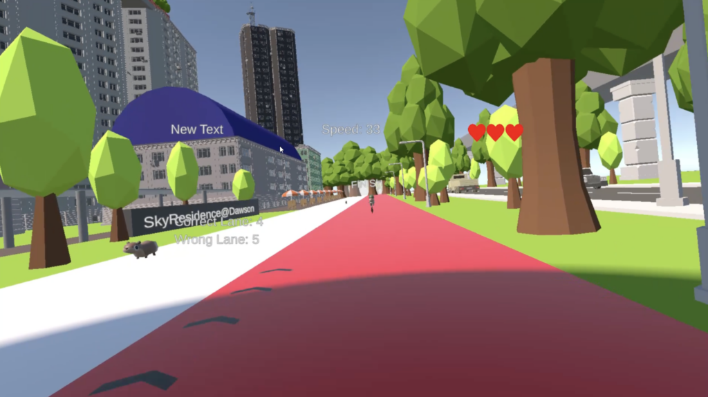
The environment was built from two LiDAR scans of 38 Commonwealth Avenue and rendered using Gaussian Splatting on Unity, giving players a realistic and immersive experience grounded in actual on-the-ground conditions.
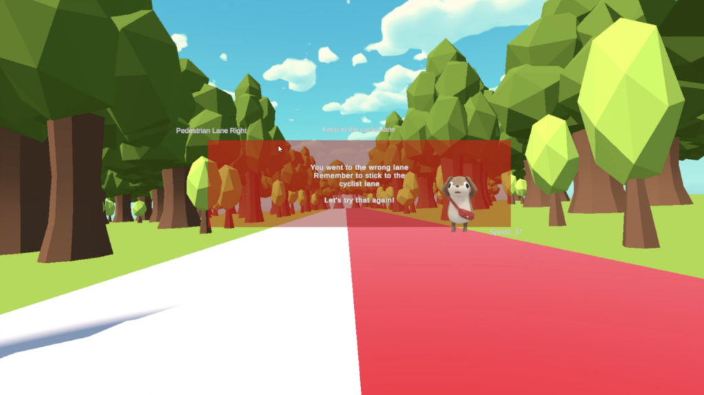
Pedestrians are scored on Safety (lives lost from NPC collisions), Lane Compliance (points per second on the correct path, with penalties for crossing into the cyclist lane), and Focus (penalties for tapping virtual phone pop-ups). Cyclists are scored on Safety, Lane Compliance, and Speed Control across three tactile strip zones: Green (at or below 25 km/h), Yellow (at or below 10 km/h), and Red (at or below 6 km/h). Penalties apply for every 0.25 seconds of delay in reaching the required speed upon entering each zone.
Impact is measured through a pre and post-game survey with 17 scored questions per player, split into 9 shared questions and 8 role-specific questions. Every question maps directly to one of the 6 key messages across both roles, so any knowledge gain is attributable to specific in-game content rather than general awareness.
We track four metrics: an average score lift of at least 5 points per player, a per-message pass rate of at least 70% correct post-game, role-specific gains for both pedestrians and cyclists, and an increase in awareness of LTA’s Stay on Track campaign.
Outdoors, success is measured by observing at least 40% of AMD users slowing down at the relevant tactile strip areas. Together, these metrics give us a clear and quantifiable picture of whether our solution achieved real behavioural impact.