Project 20- MSO – Safe Paths for All

Nudging Safer Behaviours Through Intuitive Path Design

Introducing Project 20- MSO – Safe Paths for All

Singapore’s Land Transport Authority (LTA) has implemented several measures in recent years to promote safer sharing of public paths among pedestrians and Active Mobility Device (AMD) users, such as cyclists. One notable initiative is the Active Mobility Act, introduced in 2018, which establishes a comprehensive safety code of conduct for all path users. Despite these efforts, an average of 90 unsafe incidents involving injuries and fatalities have been recorded annually between 2017 and 2022. In light of these challenges, our project presents a solution in the form of an innovative path marking. This intuitive design intervention is intended to subtly nudge users towards more respectful behaviour by encouraging them to pay closer attention to their surroundings and to slow down in critical areas. Scan the QR code displayed in the image to view a Twinmotion visualisation of our path marking integrated onto the actual site outside Changkat Primary School.

Team members

Chua Shuei Ray Eusebius (ASD), Andy Low Zhi Hao (ESD), Lee Chun Wai (ESD), Hon Xue Yi (ESD), Toh Hong Jing (CSD), Chew Kia Hwee (CSD), Yeo Hai Feng (ASD)

Instructors:

  • Michael Budig

  • Geraldine Quek

Writing Instructors:

  • Grace Kong

  • Dominic Quah

Project Roadmap

Discover

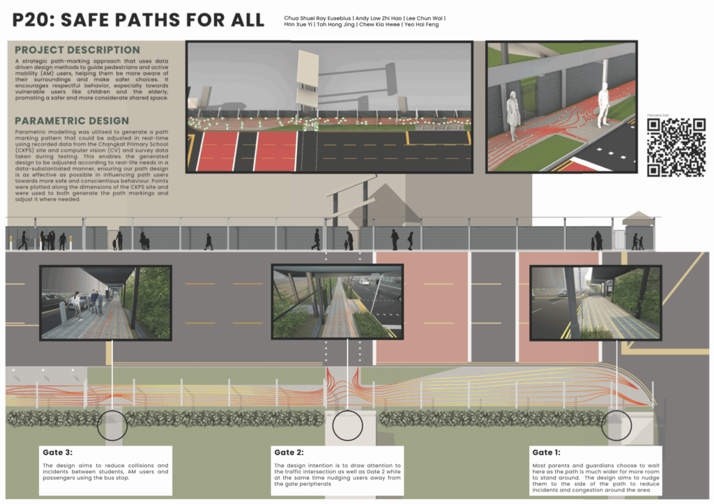
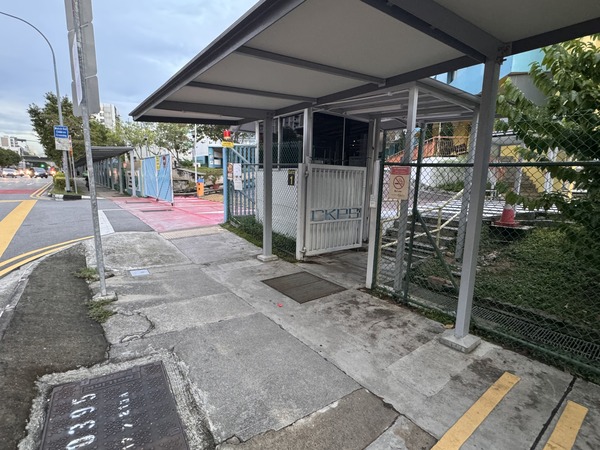
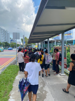
In the initial discovery phase of our project, we conducted on-site analysis outside Changkat Primary School to understand the real-world interactions between pedestrians and Active Mobility Device (AMD) users. Through these observations, we identified high-traffic zones where shared path usage frequently led to crowding, near-misses, and discomfort—particularly during peak hours. By closely examining user behavior at these sites, we categorized path users based on their mobility patterns and vulnerability. For instance, school children, elderly pedestrians, and caregivers with young children were found to be more susceptible to potential collisions due to their slower pace or limited awareness. These insights were crucial in shaping our understanding of the problem and informing the development of a solution tailored to the local context and user needs.

Define

If the vibes were clearer, maybe people wouldn’t keep crashing into each other

Building on insights gathered during the Discover phase, we synthesized our findings and defined the core challenge: public paths lack intuitive visual cues that promote respectful and safe sharing between vulnerable pedestrians and faster-moving AMD users. While policies like the Active Mobility Act set expectations, they do not adequately influence on the ground behavior, especially in high-traffic or constrained areas. The absence of visual or environmental nudges leads to friction, unpredictability, and safety risks. Our problem statement was thus refined to: How might we design implementations to influence path users to cultivate respect for each other’s safety, especially towards more vulnerable users?​

Develop

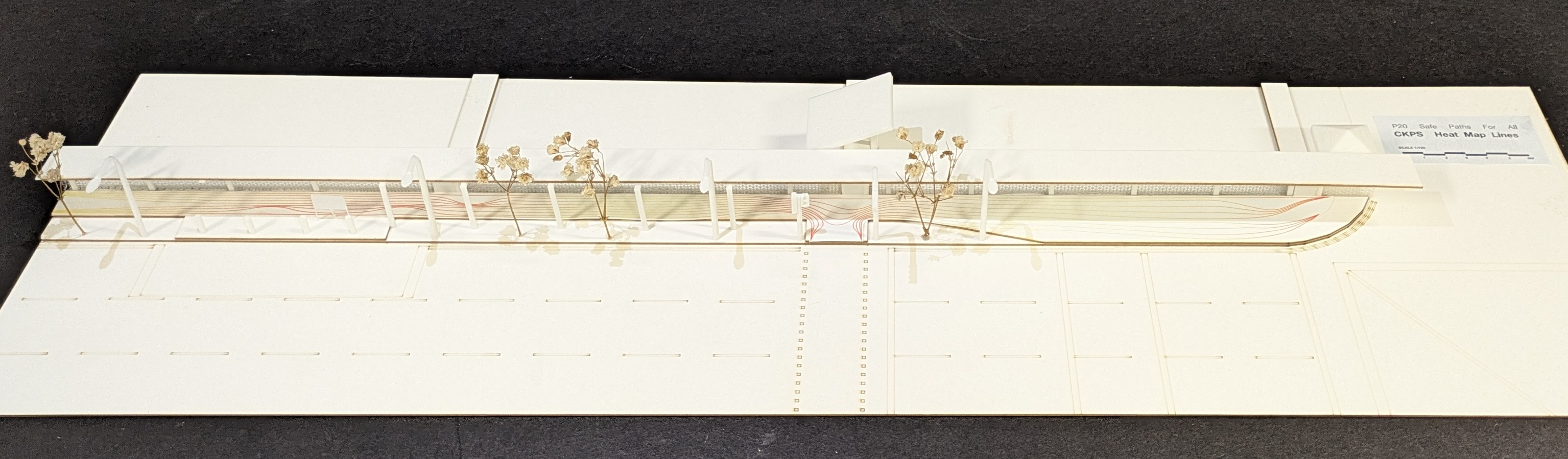
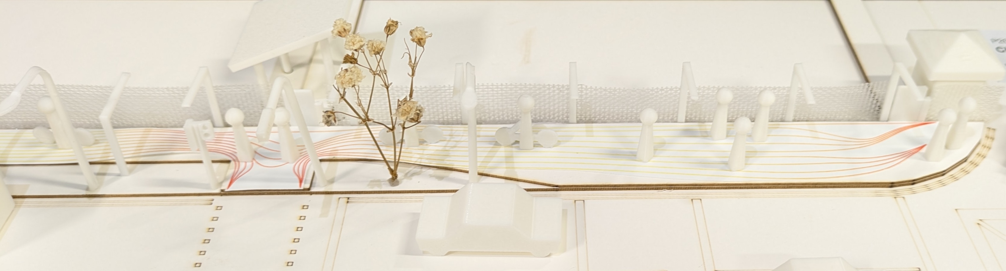
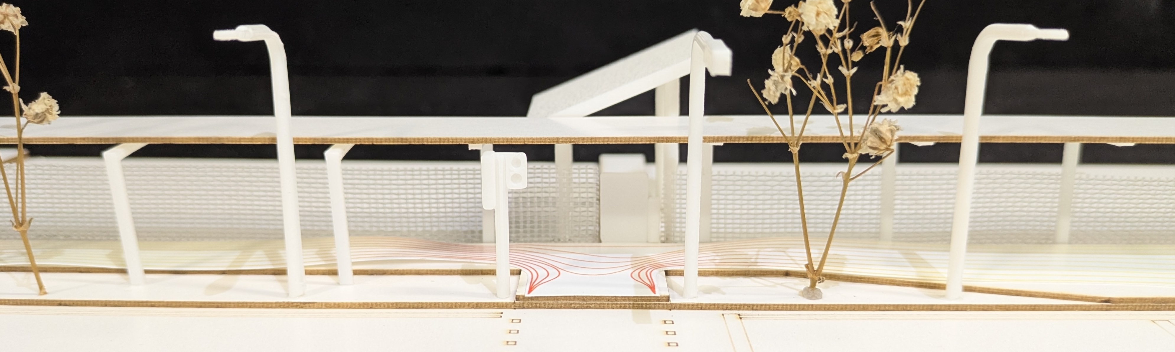
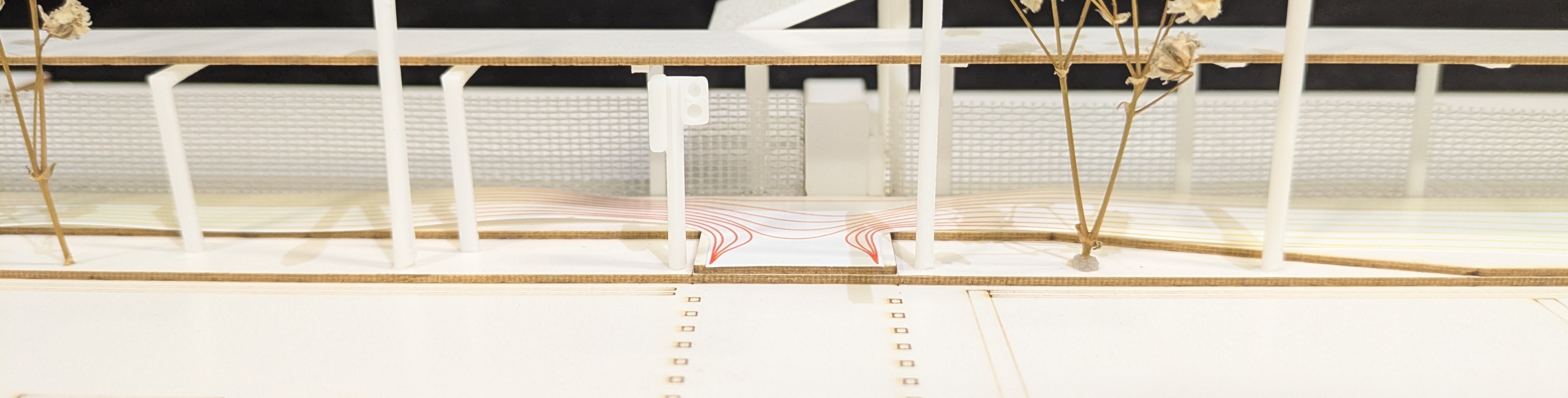
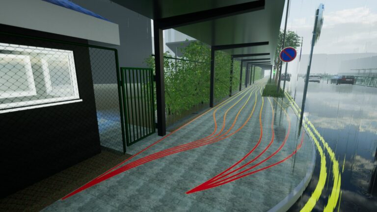
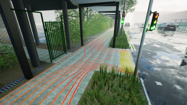
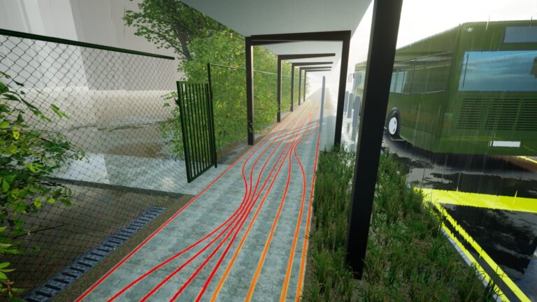
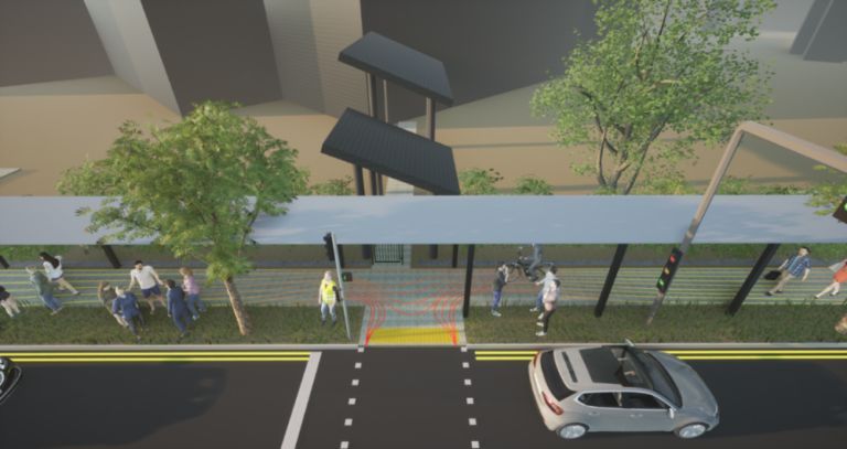
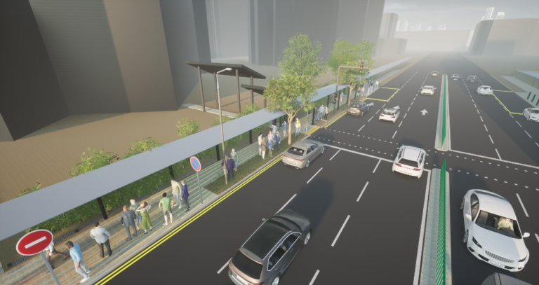
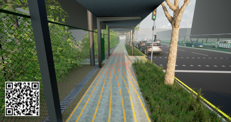
Located along a busy pedestrian walkway frequently used by both Active Mobility Device (AMD) users and vulnerable pedestrians, our intervention uses visual rhythm and color to subtly influence movement behavior. Inspired by spatial storytelling and dynamic surface design, the path features flowing wave-like markings that intuitively guide users through shared spaces, encouraging users to reduce their speed and be more aware of their surroundings.

Drawing from the principles of playful urbanism, the design transforms an utilitarian path into an engaging, multi-sensory environment. Much like Copenhagen’s Red Square, our solution leverages on color psychology and visual disruption to create a sense of interaction and attentiveness. The wave patterns not only beautify the path but also act as a gentle behavioral nudge. This encourages users to slow down and make space for others, fostering mutual respect in a shared urban space.

Ultimately, this intervention is not just about markings—it’s about reshaping the social dynamics of movement in a way that is intuitive, inclusive, and rooted in everyday experience.

Parametric Path Marking Design Using Rhino 7 and Grasshopper

This image showcases the final parametric path marking design created using Rhino 7 and Grasshopper. Leveraging a 1:1 scale site models and behavioral insights from field observations, the team strategically placed control points along the walkway to influence user movement at critical zones. These points were interpolated to form boundary and guiding curves, which were then processed using “Tween” nodes to generate the final flowing line patterns. The design was iteratively refined in real time—zooming into attention zones such as school gates and bus stops—to ensure the lines responded sensitively to context, guiding movement and encouraging slower speed of AMD users. Once finalized, the design was “baked” into Rhino, scaled for print, and exported with gradient overlays in Adobe Illustrator, ready for visual testing and implementation.

Site Render & Visusalisation

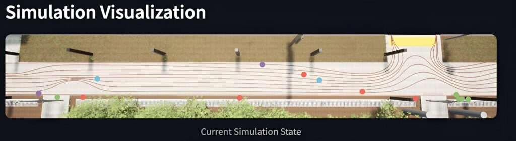
1:1 scale of human models were then placed into the site for perspective. In this manner, the look and feel of the design vis-a-vis path users can be more accurately determined. When the path markings have been deemed proportionate and suitable, they are baked as curves into Rhino 7 for rendering purposes. To enhance their visual appearance, their print width can be increased in the layers. 

Path Markings at CKPS Gates

Curved lines create negative space to divert AMD users from school gates, while straight lines guide pedestrians to the edges of the path. A heat map gradient from yellow to red highlights risk zones, with red indicating high risks zones. These markings are placed outside all three Changkat Primary School gates to promote safer shared path
/

Testing and Computer Vision

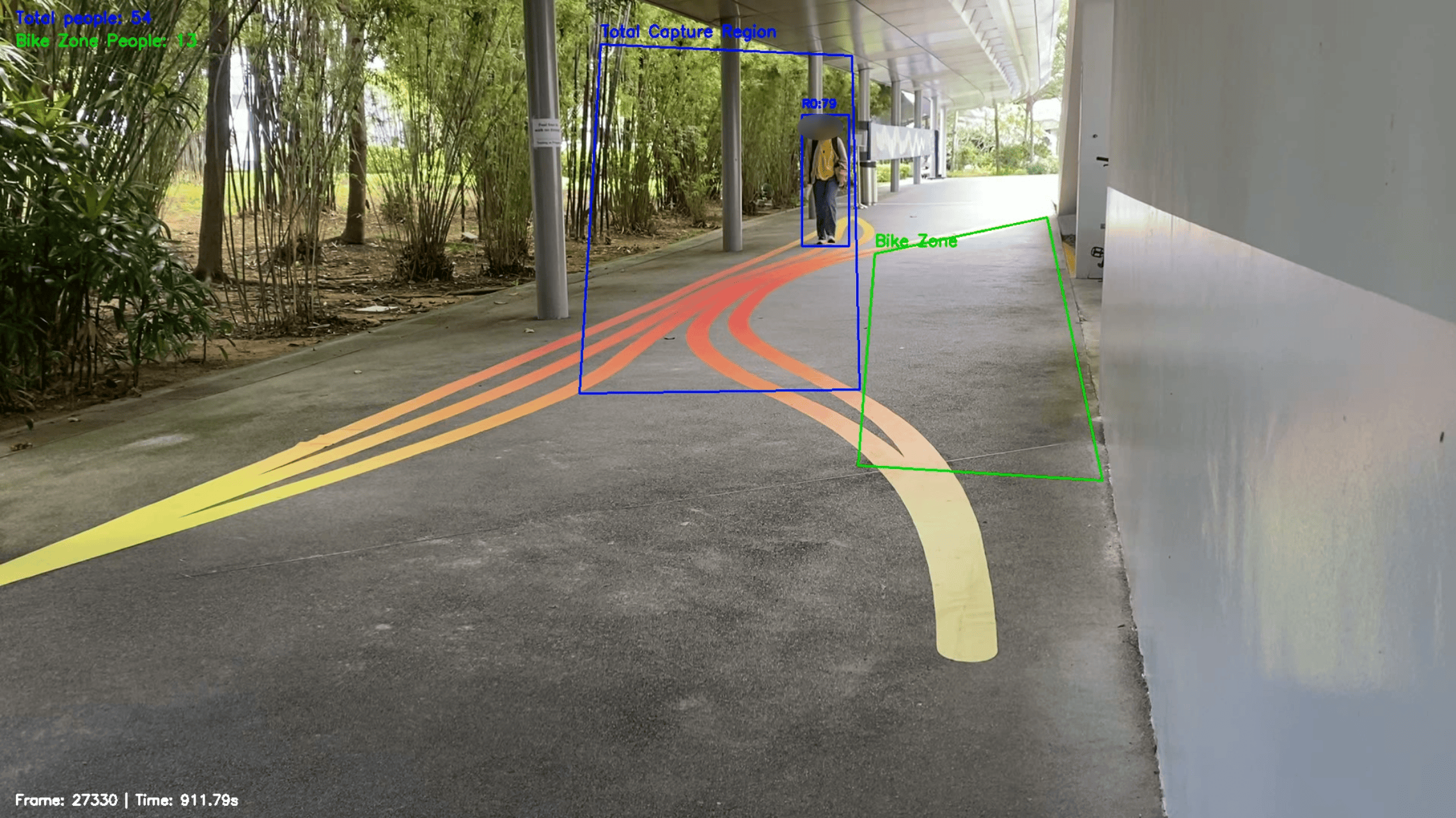
SUTD’s hostel walkway was used for physical testing to mimic CKPS gates, observe users’ interactions and assess behaviours. The bicycle area served as a attention zone where cyclists enter/exit from, while the perpendicular walkway provided foot traffic by students and residents

Computer Vision was used to assess the effectiveness of our path markings on the testing site. Using the YOLOv12 image detection model, we were able to gauge whether path users followed our intended behavior. The blue region tracks the total amount of all path users who passed through our test site, while the green region tracks the total amount of path users who pass through the dangerous bike zone. By calculating the percentage of path users who steer away from the bike zone before and after the path markings were implemented, we can determine how effective our path markings are.

In the end, our program detected a 11.6% increase of path users steering away from the bike zone, suggesting that our path markings were effective in influencing behaviour.


Before Implementation
During Implementation
After Implementation

Before the path markings were implemented, 143 (68.1%) out of 210 participants steered away from the danger zone.

When the path markings were implemented, 169 (79.7%) out of 212 participants steered away from the danger zone.

After the path markings were implemented, 251 (88.1%) out of 244 participants steered away from the danger zone.

Agent Based Modeling

To evaluate the effectiveness of our final “Heat Map Lines” path marking design in enhancing safety outside Changkat Primary School, we employed agent-based modeling to simulate interactions between pedestrians and Active Mobility Device (AMD) users. In our simulation, agents representing schoolchildren, caretakers, general pedestrians, and cyclists were assigned realistic adherence rates to the path markingsranging from:

  • 50–80% for schoolchildren
  • 60–90% for caretakers
  • 30–70% for general pedestrians
  • 20–60% for cyclists

The results were compelling: the heat map design resulted in only 3 collisions and 4 near misses by the end of the simulation, demonstrating its strong potential to reduce unsafe incidents and promote safer interactions on shared public paths.

Acknowledgements

Our team would like to thank our Capstone instructors: Dr. Geraldine and Adjunct Associate Professor Michael Budig for their keen insight which helped to steer our project direction. Their suggestions were instrumental to the formation of a holistic solution that showcased the strength of each team member.

Furthermore, our team would like to thank SUTD’s Office of Campus Infrastructure and Facilities (OCIF) and SUTD’s Institutional Review Board (IRB) for their work in enabling the team to test our design on campus. In addition, our team thanks MSO and LTA for their invaluable feedback towards our solution.

Finally, our team would also like to thank our writing instructors: Mr. Dominic Quah and Ms. Grace Kong for vetting our presentations and reports and Assistant Professor Kenny Choo for his advice regarding the implementation of VR for showcasing the project.


Menu

ornament-menu

Contact the Capstone Office :

+65 6499 4076

8 Somapah Road Singapore 487372

Please fill in your information below and feedback

Contact the Capstone Office :

8 Somapah Road Singapore 487372

8 Somapah Road Singapore
487372

Welcome back!

Log in to your existing account.

Contact the Capstone Office :

+65 6499 4076

8 Somapah Road Singapore 487372

Welcome back!

Log in to your existing account.